Using the latest deep sea technology, the team brought back amazing images and data from the seabed.
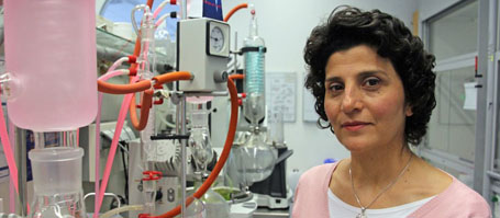
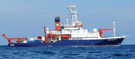
Huge unmanned crawler vehicles move along pre-programmed paths on the seafloor and rake the soft ground in search of polymetallic nodules – future mining of the deep sea could look like this. But how profoundly will such mining activities influence the ecosystem of the seafloor? How long will it take nature to heal these wounds? These are the fundamental questions addressed by the joint European research project “JPIOceans - Ecological Aspects of Deep-Sea Mining”. From end of July to end of August scientists from Germany, Portugal, the United Kingdom, Belgium and the Netherlands onboard the German research vessel SONNE worked in the eastern equatorial Pacific to find answers to those questions. With the autonomous underwater vehicle AUV ABYSS they created one of the largest high-resolution photo-mosaics of the ocean floor so far. “Both, the technology we used and the results are remarkable,” says cruise chief scientist Professor Dr. Jens Greinert of the GEOMAR Helmholtz Centre for Ocean Research Kiel.
The so-called DISCOL area was the destination of the SONNE expedition with the official number SO242/1. The area is part of the more than 4,000 m deep Peru Basin. DISCOL stands for “DISturbance and re-COLonization experiment". In 1989, German scientists ploughed about 2.5 square km of a well-defined, 11 km2 large area, where manganese nodules occur on the ocean floor. The aim was to study the long-term impact of such activities in the deep sea.
In the years 1992 and 1996, expeditions followed to monitor the ecosystem’s response in the ploughed grounds. Now, 19 years after the last cruise to the DISCOL area, an international research team on RV SONNE had the opportunity to take a close look at the seabed again. "Fortunately, the deep-sea technology has improved a lot since the 1990s," says Professor Greinert.
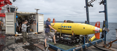
Among the technologies that were not available in the 1990s are autonomous underwater vehicles such as the AUV ABYSS of GEOMAR. In up to 6,000 m depth it can follow pre-programmed courses for more than 20 hours, mapping the seabed minutely with multibeam echosounders and side-scan sonars. “A newly developed lighting technology also permits us to take color images of the seabed,” explains Professor Greinert. During the expedition, the AUV took several hundred thousands of photos of the seabed at close range. The scientists assembled them to a photomosaïc of the seafloor in unprecedented high resolution.
Another advantage of the AUV is that it saves valuable time. While the device works autonomously in the deep, RV SONNE could take samples elsewhere. “During this cruise we fully exploited the capabilities of the AUV and it worked out very well,” says Professor Greinert. Apart from this, the research group congratulated AUV ABYSS to its 200th dive.
As with all scientific expeditions, the data, maps, photos, and samples collected must now be analyzed in detail. “However, the first results are very exciting as well," says Professor Greinert. The plough tracks of 1989 can still clearly be seen and the disturbed regions have not been recolonized yet. At the same time, the images show that a few decimetres from the plough tracks, normal deep-sea life exists. “The expedition proved that the deep sea is not an area that is beyond monitoring. Mining activities can be monitored efficiently, the technology is already available."
Currently, a follow-up team of the JPIO project led by Prof. Dr. Antje Boetius of the Alfred Wegener Institute Helmholtz Centre for Polar and Marine Research is working in the DISCOL area. During this leg of the cruise, which lasts until early October, detailed biogeochemical investigations of the disturbed habitats are the primary objective. In a joint project blog, the participants report about their activities onboard. “In the end we will have a fascinating record of the deep sea in this area," says Greinert.
Links:
www.geomar.de GEOMAR Helmholtz Centre for Ocean Research
http://jpio-miningimpact.geomar.de website of the project "Ecological Aspects of Deep-Sea Mining" with the Expedition Blog
http://www.oceanblogs.org/sonne-oasis the SONNE OASIS Expedition Blog on Oceanblogs
Images:
At www.geomar.de/n3996 images are available for download.
Contact:
Jan Steffen (GEOMAR, Communikation & Media), Phone: 0431 600-2811, presse@geomar.de
…