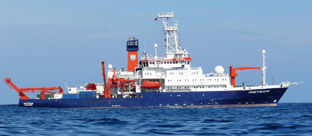
On August 21st the expedition MSM-45 of the research ship “Maria S. Merian”, with scientists from Germany, Denmark, Peru and Canada, will come to an end. The sediment cores gathered offer insight into 25,000 years of Labrador Sea climate history, which, when documented and compared to current observations, will allow conclusions about today’s changing climate.
The Labrador Sea is one of the most important marginal seas in subpolar regions. It lies between Greenland and Canada. The deep water formation in this region is said to act as a stabilizer of the North Atlantic thermohaline circulation which transports warm water into the north with the North Atlantic current and thus has a significant influence on the mild climate in northern Europe and North America. A key factor is the freshwater and saltwater balance in the Labrador Sea. If the balance becomes unsettled, e.g. by fast melting glaciers on Greenland, the North Atlantic current might be weakened and the climate in the middle and higher latitudes of the northern hemisphere might cool down.
The aim of the research expedition MSM-45 is therefore to gain a better understanding of the influence of a large freshwater influx on the global conveyor belt of currents. For this reason, sediment layers are being studied which provide information on times of extreme, natural climate fluctuations. These occurred, for example, during the transition from the last ice age (25,000 years ago) to the current interglacial period. This data will be compared to observations made today.
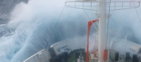
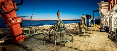
The echo sounding measurements from a hydro acoustic measuring system on board form the basis for detailed maps and profiles of the upper sediments which are used to identify the “youngest” geological areas from the Holocene, and retrieve high resolution sediment cores for a climate archive of the Labrador Sea. There are only a small number of areas on the shelfs and continental slopes which have Holocene sediments several meters thick, covering the deposits of the last ice age and the melting phase of the ice sheet before the current phase. Hence the challenge of the expedition has been the intensive mapping of the sea floor as well as locating and sampling the few existing, undisturbed deposits of the current interglacial phase. Only with these sediments can – after sample studies in Kiel laboratories – the paleoceanographic changes in the Labrador Sea be reconstructed in detail for the last 25,000 years.
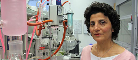
“There are only a few places on the continental slopes and shelfs off West Greenland and north-east Canada which are suitable for retrieving samples. After intensive mapping, we were able to obtain about 250 meters of sediment cores, which, after first evaluation are of outstanding quality and will be able to give us insight about the climate history of the past 25,000 years,” says expedition leader Ralph Schneider from the Institute of Geosciences at Kiel University and co-speaker of the Cluster of Excellence “The Future Ocean”, very happy with the first success of the expedition.
The research expedition MSM-45 comes to an end on the 21st of August 2015 when the Maria S. Merian comes into port at the Canadian coastal city of Halifax. The end will be marked by a public open ship event in which, together with Dalhousie University in Halifax, the research team allows interested visitors a look at life and work aboard the Maria S. Merian. The expedition with the research ship is one example of a successful international cooperation of Kiel Marine Sciences at Kiel University and the Canadian University. Since 2012 the German-Canadian graduate program HOSST/TOSST has brought the countries closer. Supported by the two universities and the GEOMAR Helmholtz Centre for Ocean Research Kiel, PhD students study the complex system of the North Atlantic. Young scientists of all three internationally renowned marine research institutes have been conducting their research on board. They report about their experiences in the expedition blog of the Kiel Marine Sciences at www.oceanblogs.org/msm45
Links:
www.oceanblogs.org/msm45 (Expedition Blog of the MSM-45)
www.futureocean.org (Cluster Of Excellence “The Future Ocean”)
www.ldf.uni-hamburg.de/merian/wochenberichte.html The weekly log of the MSM45
www.dal.ca/faculty/science/about/Outreach/open_ship.html Open Ship Halifax
www.geomar.de/de/studieren/phd/hosst/about-us-aim Graduate program HOSST/TOSST
Contact
Professor Dr. Ralph Schneider, Institute of Geosciences, Kiel University
schneider@gpi.uni-kiel.de
Friederike Balzereit, Public Outreach, The Cluster of Excellence “The Future Ocean”, Telephone: +49 431-880-3032
fbalzereit@uv.uni-kiel.de
…