Geologists from the GEOMAR Helmholtz Centre for Ocean Research Kiel and the Cluster of Excellence "The Future Ocean", the Institute of Marine Sciences (CSIC) in Barcelona (Spain), and the German Institute for Geosciences and Natural Resources (BGR) now publish a possible explanation in the international journal Nature Communications.
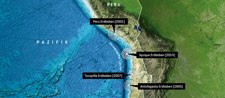
Chile is one of the countries that is most at risk from damaging earthquakes. Therefore, no one was caught by surprise when a series of tremors struck the area around the northern Chilean city of Iquique in spring 2014. The main quake on 1 April reached a magnitude of 8.1 and triggered a tsunami. But experts were surprised that the quake was not as large and damaging as expected, and that it affected only a limited region. Geologists from the GEOMAR Helmholtz Centre for Ocean Research Kiel and the Cluster of Excellence "The Future Ocean", the German Institute for Geosciences and Natural Resources (BGR) and the Institute of Marine Sciences (CSIC) in Barcelona (Spain) now presented a possible explanation for the smaller than expected tremor. They published their findings in the international journal Nature Communications.
The reason for the high earthquake frequency in Chile lies just off the coast where the oceanic Nazca plate, one of several tectonic plates in the Pacific region, subducts underneath the South American plate. This leads to the accumulation of stress that will sooner or later, be released during an earthquake. "In northern Chile, however, there is a 550 kilometer wide gap that did not experience a major earthquake since 1877," says the lead author of the current study, Dr. Jacob Geersen (GEOMAR/The Future Ocean). "Within this seismic gap, experts expected the next mega earthquake. And at first, many scientists believed the earthquake on 1 April 2014 was this mega quake. But it affected only the central part of the gap and remained well below the expected magnitude of up to 9.0," says Dr. Geersen.
To understand the reason for the low intensity of the 2014 Iquique earthquake, Dr. Geersen and his colleagues studied the seafloor topography off northern Chile combined with seismic images that resolve the deep structure under the seafloor. The seismic data were already collected in 1995 by the BGR in the framework of the "Crustal Investigations off- and on-shore Nazca / Central Andes (CINCA)" research project. "It turned out that the seafloor of the Nazca plate in the affected region is not entirely flat. Instead, there are numerous extinct volcanos, so called seamounts, some of them thousands of meters high," describes co-author César R. Ranero, ICREA Research Professor at the Institute of Marine Sciences (CSIC) in Barcelona.
These seamounts are, together with the Nazca plate, pushed beneath the South American Plate. "Using the seismic data, we clearly identified several former seamounts, which are now located at the interface between the two plates, thereby actively deforming this interface and the overlying South American Plate," says Dr. Geersen. Because of this roughness and the associated fractures, less stress is build up in the area around the subducting seamounts and the resulting earthquake is smaller. "In addition, the subducted seamounts probably stopped the spatial propagation of seismic rupture physically during the Iquique earthquake," says Dr. Geersen.
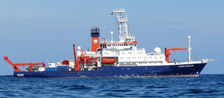
The risk of a future mega earthquake in the seismic gap of northern Chile is not yet reduced. "A portion of the accumulated stress has now been released by the 2014 earthquake. However, in the unbroken northern and southern portion of the seismic gap there is still enough energy that remains to be released during an earthquake with a magnitude larger than 8.5" says Dr. Geersen. Therefore, scientists from around the world continue to monitor the region. In autumn 2015, a team of GEOMAR scientists will also visit the area off northern Chile onboard the German research vessel SONNE in order to install high-precision instrumentation on the seabed that is capable of detecting even small centimeter-scale movements of the subsurface. "We are yet to forecast earthquakes precisely. But the more we learn about them the better we can assess the associated risks and take mitigation efforts" concludes Dr. Geersen.
Reference:
Geersen, J., C. R. Ranero, U. Barckhausen, C. Reichert (2015): Subducting seamounts control interplate coupling and seismic rupture in the 2014 Iquique earthquake area. Nature Communications, https://dx.doi.org/10.1038/ncomms9267
Links:
www.geomar.de Das GEOMAR Helmholtz-Zentrum für Ozeanforschung Kiel
www.ozean-der-zukunft.de Der Exzellenzcluster „Ozean der Zukunft“
footage:
Unter www.geomar.de/n3993 steht Bildmaterial zum Download bereit.
Contact:
Jan Steffen (GEOMAR, Communication & Media), Tel.: 0431 600-2811, presse@geomar.de
…


